Carew Cheriton Control Tower
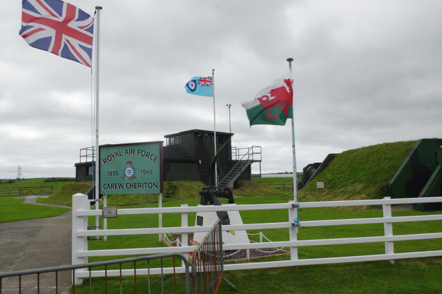
Carew Cheriton Control Tower stands as one of the most evocative and well-preserved Second World War aviation relics in Wales. Located near the village of Carew Cheriton in Pembrokeshire, southwest Wales, the concrete control tower is the most prominent surviving structure of what was RAF Carew Cheriton, a wartime airfield that played a meaningful role in Coastal Command operations during the Battle of the Atlantic. The tower itself is listed as a scheduled ancient monument, reflecting its recognized importance as a piece of twentieth-century military heritage. For aviation history enthusiasts, wartime archaeology lovers, and those simply captivated by the quiet dignity of ruins that have outlasted the storms of history, this is a genuinely compelling site.
RAF Carew Cheriton was established in the late 1930s and became operational during the early years of the Second World War. It was primarily used by RAF Coastal Command, whose aircraft patrolled the Western Approaches and the Atlantic seaways, hunting German U-boats and protecting Allied shipping convoys. The airfield hosted a number of squadrons flying aircraft such as the Lockheed Hudson and the Avro Anson, conducting long maritime patrol missions over dangerous open water. The strategic importance of Pembrokeshire as a base for such operations cannot be overstated — the peninsula jutted far enough into the Celtic Sea to give aircraft meaningful additional range over the critical sea lanes. The airfield also had associations with training and communications roles as the war progressed. After the war ended, the airfield was decommissioned and the land returned largely to agricultural use, but the control tower was left standing, an accidental monument to the thousands of aircrew who flew from this quiet corner of Wales.
The control tower itself is a compact, utilitarian structure built in the functional military style of the period, constructed from reinforced concrete that has weathered the decades with remarkable stubbornness. It rises two storeys, with the upper level featuring the characteristic wraparound windows of a wartime watch office, designed to give controllers a panoramic view of the airfield's runways and circuits. The concrete is stained and patched with age, with vegetation beginning to work its way into cracks, and the interior is hollow and open to the elements, giving it a melancholy, skeletal atmosphere. Standing beside it, you are struck by how small and modest it is compared to the enormous logistical enterprise it once directed — yet that modesty is part of its power. The wind comes in off the surrounding farmland with little to break it, and on grey Pembrokeshire days the silence around the tower feels loaded with absence.
The landscape surrounding the site is quintessential south Pembrokeshire — broad, gently rolling agricultural land under wide Atlantic skies, with the estuary of the Carew River not far to the east and the tidal flats and marshes of the Daugleddau estuary system beyond. The flatness of the terrain, which made it suitable for an airfield in the first place, still gives the area a sense of open exposure unusual for Wales. Nearby, the village of Carew itself is well worth visiting: it contains the spectacular medieval Carew Castle, one of the finest castle ruins in Pembrokeshire, and the extraordinary Carew Cross, an eleventh-century Celtic cross considered one of the finest examples in Wales. The Carew Tidal Mill, a restored working tidal mill beside the castle pond, adds further historical texture to an already rich immediate neighbourhood. Pembroke town is only a few miles to the west, and the Pembrokeshire Coast National Park surrounds the broader area.
Visiting the control tower requires a degree of initiative, as it is not a formally managed tourist attraction with staffed opening hours or facilities. The tower sits within or adjacent to privately managed land that was partly developed into a business park and light industrial estate on the former airfield footprint, which is a jarring but not uncommon fate for wartime airfield sites. Access to view the exterior of the tower is generally possible, but visitors should be respectful of any private land designations and should not attempt to enter the structure itself given its deteriorated and potentially unsafe condition. There is no formal car park dedicated to the tower, but parking can be found nearby in Carew village, from which a short walk is possible. The site is accessible year-round, and the open Pembrokeshire landscape means it is pleasant in fine weather, though the tower itself has a particular atmosphere on overcast days that feels entirely appropriate to its history. Given the proximity of Carew Castle, which is managed by Pembrokeshire Coast National Park and charges a small admission fee, most visitors sensibly combine the two in a single excursion.
One of the more fascinating and lesser-known aspects of RAF Carew Cheriton's history is its role within the broader and desperately fought campaign to close the so-called Mid-Atlantic Gap — the stretch of ocean beyond the range of land-based aircraft where Allied convoys were most vulnerable to U-boat attack. The men who flew from this tower's shadow did so knowing that a mechanical failure or navigational error over the Atlantic offered little prospect of rescue. The very ordinariness of the tower, sitting now amid farm fields and industrial units, makes it a quietly powerful reminder of how ordinary places and ordinary people were drawn into the extraordinary violence of the mid-twentieth century. That scheduled monument status helps ensure the structure will not simply be demolished, preserving at least this fragment of a world that otherwise exists only in fading photographs and the memories of those who have since passed.