Nantcribba
Nantcribba is an ancient earthwork and fortified site situated in the border country of mid-Wales, near the village of Forden in Powys. The site is a prehistoric hillfort and associated earthworks that occupy a commanding position in the upper Severn Valley, a landscape that has been inhabited and contested since prehistoric times. The name itself is of Welsh origin, and the site represents one of the many Iron Age defensive structures scattered across the Welsh Marches, a zone of land that has always been a cultural and military frontier between Wales and England. What makes Nantcribba particularly notable is its layered history, sitting as it does at the intersection of prehistoric, Roman, Norman and medieval influences, all compressed into a stretch of borderland that has been strategically significant for millennia.
The origins of Nantcribba as a fortified place reach back into prehistory, with the earthworks likely first constructed during the Iron Age, a period when hillforts and promontory forts proliferated across Wales and the Marches as communities sought defensible high ground. The broader Forden area is intimately connected with Roman activity, as the Roman auxiliary fort of Lavobrinta, known as Forden Gaer, lies very close by — one of the most important Roman military installations in mid-Wales, garrisoning troops to control the upper Severn corridor and the routes into the Welsh highlands. The proximity of Nantcribba's earthworks to this Roman infrastructure suggests the site may have been part of a broader pattern of landscape control and occupation that spanned different eras. The Welsh Marches as a whole saw intense Norman activity following the Conquest, with Marcher Lords carving out territories and constructing mottes and castles throughout the region, and Nantcribba Gaer is sometimes identified as the site of a motte in the local historical record.
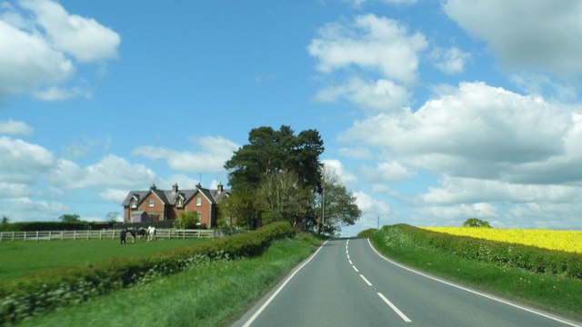
The physical character of the site is shaped by the rolling, intimate terrain of the middle Severn Valley. This is not dramatic mountain country but rather the softer, green upland fringe where the lowland plains of England begin to give way to the more rugged Welsh interior. The earthworks themselves consist of banks and ditches that are partially eroded by centuries of agriculture and grazing, yet still clearly legible to a visitor who takes the time to walk the ground carefully. The fields and hedgerows of this part of Powys have a quiet, pastoral quality, with the sounds of livestock, distant farm machinery and birdsong dominating the experience. The land is well-watered, drained by small streams running toward the Severn, and the vegetation is typical of lowland mid-Wales — lush grassland, scattered hedgerow trees, and occasional patches of bracken on the rougher ground.
The surrounding landscape is one of the most historically rich in Wales. The village of Forden lies immediately to the east and northeast, and the major Roman fort of Forden Gaer is a Scheduled Ancient Monument of national importance just a short distance away, making the area a genuine concentration of heritage interest. The town of Montgomery, with its impressive medieval castle and beautifully preserved Georgian town centre, lies only a few miles to the north and is well worth combining with any visit to the Nantcribba area. Welshpool, the principal market town of the region and home to the magnificent Powis Castle — a National Trust property with outstanding formal gardens — is only a handful of miles to the north as well. Offa's Dyke, the great early medieval earthwork that demarcated the boundary between Mercia and the Welsh kingdoms, passes through this part of the Marches, and the Offa's Dyke Path long-distance trail is accessible nearby, offering superb walking through this historically resonant border country.
Visiting Nantcribba requires some preparation, as the site is essentially a rural earthwork in an agricultural landscape rather than a managed heritage attraction with facilities or formal access infrastructure. The nearest settlements for parking and amenities are Forden and the slightly larger Churchstoke to the south. Access to earthwork sites of this type in Wales is generally via public footpaths and rights of way, and visitors should consult the Ordnance Survey mapping for the area, specifically the OS Explorer Map 216 (Welshpool and Montgomery), before setting out. The best times to visit are late spring through early autumn, when the days are long and the ground conditions are most favourable, though the border country has a particular melancholy beauty in autumn and winter when the bare hedgerows reveal the underlying topography of the landscape more clearly. Visitors should wear appropriate footwear for potentially muddy field conditions and respect any agricultural activity on surrounding land.
One of the quietly fascinating aspects of Nantcribba and its surroundings is the way in which the landscape has continuously attracted human settlement and military attention across more than two thousand years, almost certainly because of its position controlling a natural routeway through the upper Severn Valley toward the heart of Wales. The name Gaer, which appears in connection with the site, is a Welsh word derived from the Latin caer, meaning fort or fortified place, and its use in Welsh place names almost always signals a site with Roman or early medieval military associations. This linguistic fossil embedded in the landscape is itself a kind of archaeology, pointing visitors toward a past that the green fields and quiet hedgerows might otherwise conceal entirely. For those interested in the deep history of the Welsh Marches, Nantcribba represents a small but genuine piece of a much larger story about how peoples, armies and cultures have moved through and contested this border country across the full sweep of recorded and prehistoric time.