Pen-y-Coedcae
Pen-y-Coedcae is a small settlement and locality situated in the Rhondda Cynon Taf county borough of South Wales, lying in the undulating terrain between the industrial valleys and the broader lowland fringes north of Pontypridd. The name itself is Welsh in origin and translates roughly as "the head" or "top of the wooded field" — a compound of "pen" (head, top, or end), "y" (the), "coed" (trees or wood), and "cae" (field or enclosure) — which speaks to the agricultural and woodland character the area once possessed before the sweeping industrial changes of the nineteenth and twentieth centuries reshaped so much of this part of Wales. It is not a dramatic tourist destination in the conventional sense, but rather one of those quietly authentic Welsh localities that rewards visitors interested in vernacular settlement patterns, valley-edge landscapes, and the layered social history of the South Wales coalfield region.
The surrounding area carries deep traces of the industrialisation that transformed South Wales from the late eighteenth century onward. Pontypridd, lying immediately to the south and southeast, was one of the great hubs of the coalfield era, famous for its remarkable single-arch bridge built by William Edwards in 1756, and for its position at the confluence of the Taff and Rhondda rivers. Pen-y-Coedcae sits on the elevated ground above this confluence zone, in territory that would have been largely agricultural — smallholdings, rough grazing land, and scrubby woodland — while the valleys below hummed with colliery work, chain-making, and the movement of coal along the Taff Vale Railway. The settlement reflects the pattern common to many valley-edge communities where workers and their families occupied terraced housing on the slopes above the valley floors, maintaining a degree of separation from the industrial bustle while remaining closely tied to it economically.
Physically, the locality has the character typical of the higher ground between the Welsh valleys: a patchwork of residential streets, open rough ground, remnant hedgerows, and views that open dramatically across the valley landscape when the weather permits. The housing stock is a mixture of older Welsh terraced properties and more recent twentieth-century development. The air at this elevation tends to be fresher than in the valley bottoms, and on clear days the surrounding ridgelines of the coalfield plateau are visible in several directions. The underlying geology is the Carboniferous rock sequence — sandstones, mudstones, and coal measures — that gives the whole region its particular topographic character of steep-sided valleys and broad, flattened upland ridges.
The broader Pontypridd area in which Pen-y-Coedcae sits has considerable historical and cultural significance for Wales as a whole. This is the territory closely associated with Evan James and his son James James, who composed the Welsh national anthem "Hen Wlad Fy Nhadau" (Land of My Fathers) in Pontypridd in 1856. The Rhondda valleys to the north were among the most densely populated and intensely mined territories in the British Empire during the late Victorian and Edwardian periods, and the communities scattered across these valley edges share a heritage shaped by chapel culture, choral singing, rugby, political radicalism, and the collective memory of industrial hardship and community solidarity.
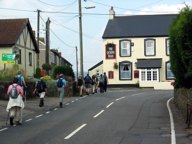
For visitors, Pen-y-Coedcae is best understood as a place to pass through or use as a base while exploring the wider Pontypridd area rather than as a destination with specific heritage attractions of its own. Pontypridd town centre is readily accessible and offers the Museum of the Rhondda and Pontypridd (housed in the historic Market building), Ynysangharad War Memorial Park — one of the finest public parks in Wales — and good transport connections via the Valley Lines rail network, which links the area to Cardiff in around twenty minutes. The A4058 and surrounding road network make the locality accessible by car, and bus services connect it to Pontypridd and neighbouring communities. The best time to visit the wider area is late spring through early autumn, when the valley landscapes are at their most appealing and the upland paths are at their most walkable.
One of the quietly compelling aspects of places like Pen-y-Coedcae is the way they embody the lived texture of Welsh valley life that is neither romanticised nor particularly documented — communities that formed organically around the edges of industrial activity, shaped by Welsh language and Nonconformist chapel culture, by migration from rural Wales and later from further afield, and by the particular solidarity that comes from shared labour and shared landscape. The Welsh placename itself is a small act of cultural continuity, preserving in everyday use a description of a landscape that in many respects no longer exists as it once did, the wooded enclosure of the name long since absorbed into the built environment of the modern settlement.