Y Bwlwarcau
Y Bwlwarcau is an Iron Age hillfort situated on a prominent ridge in the Vale of Glamorgan, South Wales. The name itself is Welsh, translating roughly to "the ramparts" or "the bulwarks," which is an apt description for what remains visible today: a series of earthwork defences that once enclosed a substantial hilltop settlement. It is considered one of the more significant prehistoric sites in this part of Wales, representing the kind of defended community that was typical of the later Bronze Age and Iron Age periods in Britain, roughly between 800 BCE and the Roman conquest. The site is scheduled as an ancient monument, recognising its national importance and offering it legal protection from development or disturbance.
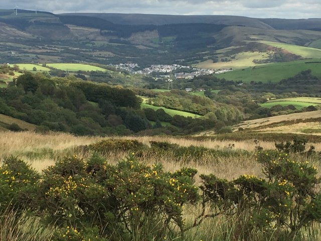
The hillfort occupies a commanding position above the village of Llanharan and the surrounding lowlands of mid-Glamorgan, and it would have been a formidable prospect to any approaching group in antiquity. The defences consist of multiple banks and ditches arranged concentrically around the hilltop, a design known as a multivallate hillfort. This form of construction suggests considerable communal effort and likely a degree of social organisation and leadership within the community that built and maintained it. The interior would have housed roundhouses, storage pits and possibly communal structures. While no dramatic single event is recorded in connection with Y Bwlwarcau, it fits into the broader pattern of Iron Age life in South Wales, a landscape dotted with hillforts that may have functioned as tribal centres, refuges, trading hubs or ceremonial spaces.
Physically, visiting the site means walking across open, often windswept ground on elevated terrain. The earthworks are still clearly legible in the landscape, with the grassy banks rising noticeably above the surrounding ground and the ditches, though partially silted over millennia, still forming distinct hollows between them. In low-angle sunlight, particularly during morning or late afternoon in spring and autumn, the ramparts cast shadows that make their full extent dramatically clear, giving even a casual visitor a vivid sense of the scale of the original construction. The hilltop itself offers wide, open skies and a feeling of exposure that must have been as strategically valuable to its Iron Age inhabitants as it is atmospherically striking to modern walkers.
The surrounding landscape is a mix of agricultural land, post-industrial South Wales valley scenery and scattered villages. The M4 motorway is not far to the south, and the town of Bridgend lies a short distance to the west, while Pontypridd is to the northeast. Despite this modern context, the ridgeline on which Y Bwlwarcau stands retains a sense of openness and antiquity. The broader area of the Vale of Glamorgan contains a rich concentration of prehistoric and early medieval sites, and visitors with a deeper interest in Welsh archaeology could combine a visit here with other nearby monuments.
Access to the site is on foot, and visitors should be prepared for uneven, potentially muddy ground, especially after rain. There is no formal visitor centre or interpretation at the site itself, so some background reading beforehand is advisable to fully appreciate what the earthworks represent. The best times to visit are during dry spells in spring or autumn, when visibility is good, the vegetation is lower, and the light is ideal for appreciating the topography. Walking boots are strongly recommended. As a scheduled monument on what is largely open or farmland, visitors should follow the Countryside Code, keeping to footpaths and respecting any grazing animals or agricultural activity in the vicinity.