Y Pigwn Marching Camps
Y Pigwn Marching Camps is a remarkable pair of Roman temporary marching camps situated high on the Mynydd Bach Trecastell plateau in the Brecon Beacons of mid-Wales. Located at an altitude of around 430 metres above sea level, these earthworks represent some of the best-preserved examples of Roman military field engineering in Wales, and indeed in the whole of Britain. The camps are significant because they reveal, with unusual clarity, the systematic and disciplined nature of Roman military campaigning in what was then the far northwest frontier of the empire's push into the highland zones of Britannia. Unlike permanent Roman forts with their stone walls and long occupation histories, marching camps were temporary overnight or short-term enclosures thrown up quickly by legionary soldiers at the end of a day's march, used briefly, and then abandoned — which makes surviving examples as well-preserved as Y Pigwn all the more extraordinary.
The camps date to the first and second centuries AD, most likely associated with the Roman campaigns to subdue the Silures and Ordovices tribes of Wales, which were among the most stubbornly resistant peoples the Roman army encountered in Britain. The larger of the two overlapping enclosures covers approximately 26 hectares and the smaller around 19 hectares, suggesting they were used on separate occasions by forces of different sizes moving through the uplands. Archaeologists believe the camps were used during the campaigns conducted under governors such as Quintus Veranius and later Gnaeus Julius Agricola in the late first century AD, as Roman forces pushed westward and northward through the Welsh mountains. The site lies close to the Roman road known as Sarn Helen, that great arterial route which threaded its way through the spine of Wales, connecting the Roman auxiliary fort at Y Gaer near Brecon in the south with forts further north, and the proximity to this road underlines the strategic importance of the plateau as a staging point for military movement.
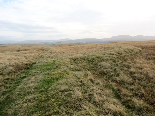
On the ground, the camps are visible as low but unmistakable earthen ramparts, typically no more than a metre or so in height today, enclosing a vast open area of rough moorland. The turf-covered banks and their corresponding outer ditches follow a broadly rectangular plan, reflecting the standard Roman playing-card shape prescribed in military manuals of the period. Walking the perimeter, you become gradually aware of the enormous scale of the enterprise — it takes considerable time to circuit even a portion of the outer bank, and the effort prompts a visceral sense of just how many men must have been involved in throwing up these defences in a single afternoon. The characteristic Clavicula entrances, where the rampart curves inward in a curved extension to prevent direct assault on the gate, are still legible in places, and these details reward patient observation.
The physical experience of visiting Y Pigwn is defined above all by the landscape itself. The Mynydd Bach Trecastell plateau is a wide, windswept expanse of heather, coarse grass, rushes and bog, with enormous skies that seem to press down from every direction on grey days and to soar boundlessly on clear ones. The views from the site are stunning in all directions — southward toward the high ridges of the central Brecon Beacons, westward across the rolling hills of Carmarthenshire, and northward toward the more austere terrain of mid-Wales. The silence here is profound and unusual, broken mainly by the wind, the alarm calls of skylarks and lapwings, and occasionally the distant sound of sheep. In wet weather the plateau can feel genuinely bleak and elemental, which paradoxically makes it easier to imagine the experience of a Roman soldier, far from the warmth of the Mediterranean world, constructing an earthwork in rain and cold on an exposed British hilltop.
The surrounding area is rich in prehistoric and Roman heritage, adding considerable depth to any visit. The Roman road Sarn Helen passes close by and can be traced as a green lane or footpath in places, offering an evocative walking route through the landscape. A short distance to the east lies the Usk Reservoir, created in the twentieth century and set amid conifer plantations. The town of Trecastle (Trecastell) lies a few kilometres to the south and gives the plateau much of its local identity. Further south still is Brecon, a market town that serves as the main centre for the Brecon Beacons National Park and is home to Brecknock Museum and the site of Y Gaer Roman fort. The wider area is one of the finest walking landscapes in Wales, falling within the Brecon Beacons National Park, with numerous footpaths and bridleways crossing the moorland.
Visiting Y Pigwn requires some planning and a degree of physical preparedness, but it is far from inaccessible. A minor road runs north from Trecastle toward the Usk Reservoir and passes close to the plateau, and from the roadside it is possible to walk across open moorland to reach the camps, which are on open access land. The walk from the road is not long — perhaps fifteen to twenty minutes — but the terrain is uneven and can be boggy, so sturdy footwear is strongly recommended. There is no formal car park at the site, and visitors typically pull off at a suitable verge. The camps are best visited in late summer when heather is in bloom and the ground is drier, or in winter on clear days when the low-angled light casts the earthworks into sharp relief and makes the ramparts most legible. Spring and autumn can bring spectacular atmospheric conditions, with cloud inversions filling the valleys below while the plateau stands clear above. There are no visitor facilities whatsoever at the site — no interpretation panels, no café, no toilets — and this rawness is entirely in keeping with the character of the place.
One of the more fascinating aspects of Y Pigwn is precisely this lack of ceremony surrounding what is, by any measure, a site of exceptional historical importance. There are Roman marching camps elsewhere in Britain that have been fenced, signposted, and interpreted with information boards, but Y Pigwn sits quietly on its windswept plateau with minimal fanfare, waiting to be discovered by those curious and determined enough to seek it out. The name itself is Welsh and refers to a peak or pointed hill, though the plateau is broad rather than sharply peaked. The dual nature of the site — two overlapping camps of different sizes — has led researchers to conclude that Roman forces passed through here on at least two separate occasions, each time digging their standardised enclosure into the same patch of high ground, perhaps because its commanding position and relatively flat surface made it the obvious choice for an army needing to camp in this part of Wales. That Roman engineers, separated by perhaps decades, independently chose the same spot speaks to a consistent military logic that is still readable in the terrain today.